Manage Projects, Forms & Data All in One Platform
Create custom forms, collect field data, track project progress, and visualize everything on interactive maps. The complete solution for construction, surveying, and field operations teams.
Trusted by 2,500+ organizations across industries
From Fortune 500 companies to growing businesses, teams worldwide rely on Oriyent
Recognized for excellence
Complete Project Management & Data Collection Platform
From custom form creation to interactive map visualization - manage your entire field operation workflow in one powerful platform.
Form Builder
Create custom forms with drag-and-drop builder. Add text fields, signatures, photos, videos, GPS coordinates, and conditional logic to capture exactly what you need.
Data Collection
Collect field data with GPS precision. Fill forms offline, capture signatures, take photos, and sync automatically when back online.
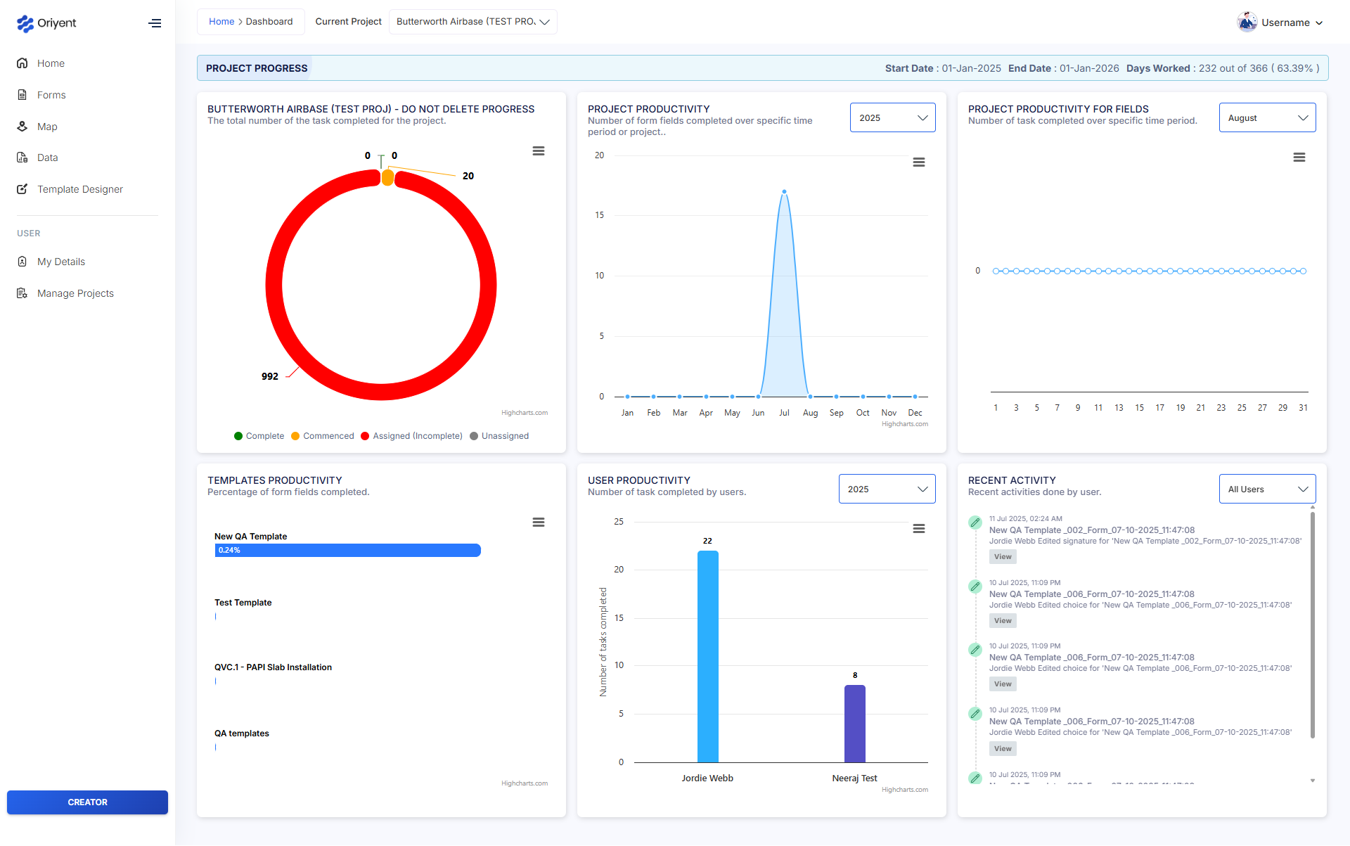
Project Management
Track project progress, manage templates, monitor productivity metrics, and view completion status across all your field operations.
Interactive Maps
Visualize all data points on interactive maps. Filter by status, date, user, or custom fields. Export maps and reports with real-time analytics.

Manage Field Workflows with GIS
Harness the Power of Spatial Data
Oriyent gives you full visibility over your projects through dynamic, map-based data. Link tasks and forms to real-world locations to streamline inspections, reporting, and asset tracking.
Structure your spatial data for maximum efficiency
Monitor field teams and asset locations live
Track project completion automatically
Identify issues before they become problems
Experience the Complete Oriyent Platform
Explore our intuitive interface designed for field teams and project managers
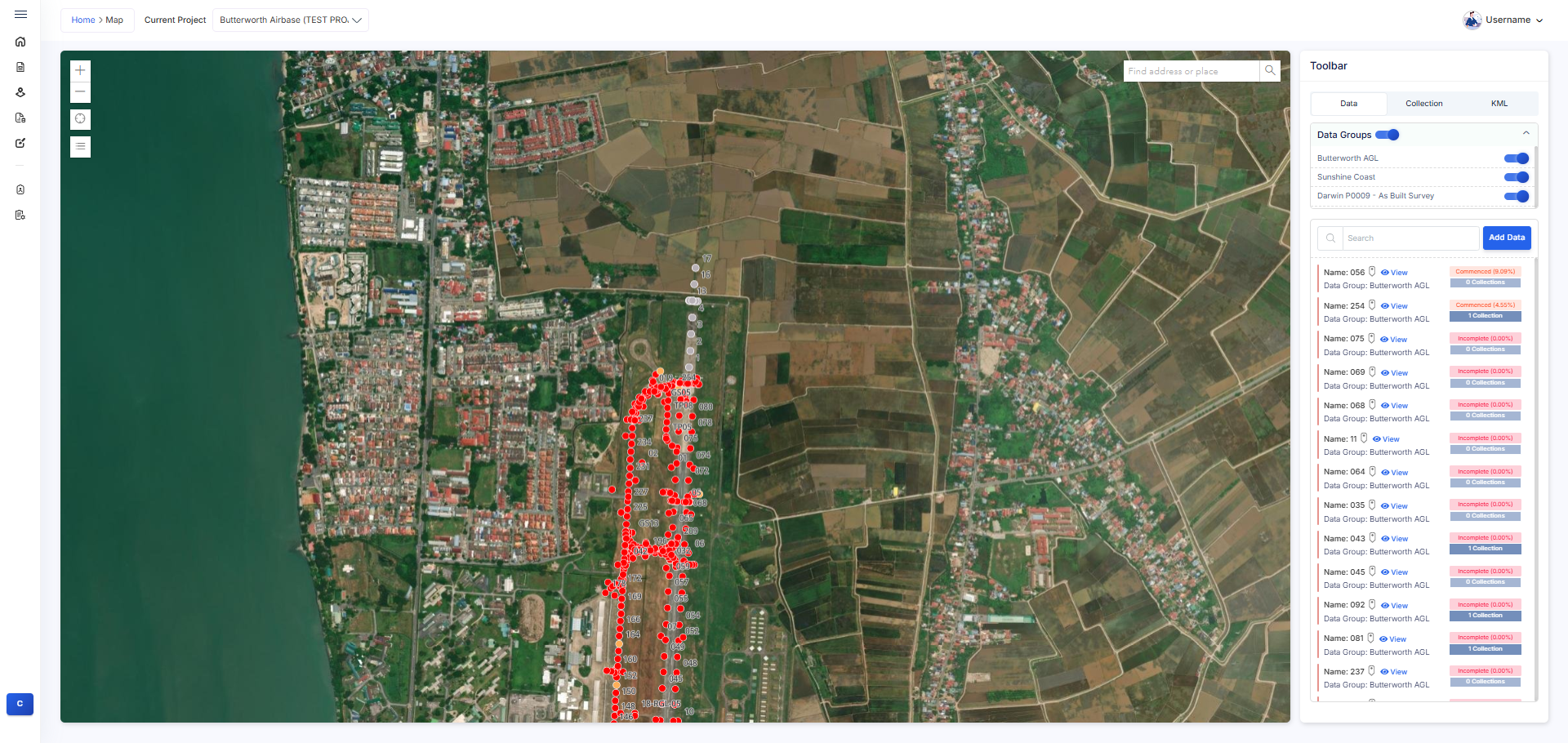
Interactive GIS Mapping
View and edit field data directly on interactive maps. Our GIS interface provides real-time location tracking, data visualization, and seamless editing capabilities with GPS precision.
Template Designer & Management
Create and manage custom form templates with our intuitive designer. Build quality checklists, inspection forms, and data collection templates tailored to your specific needs.

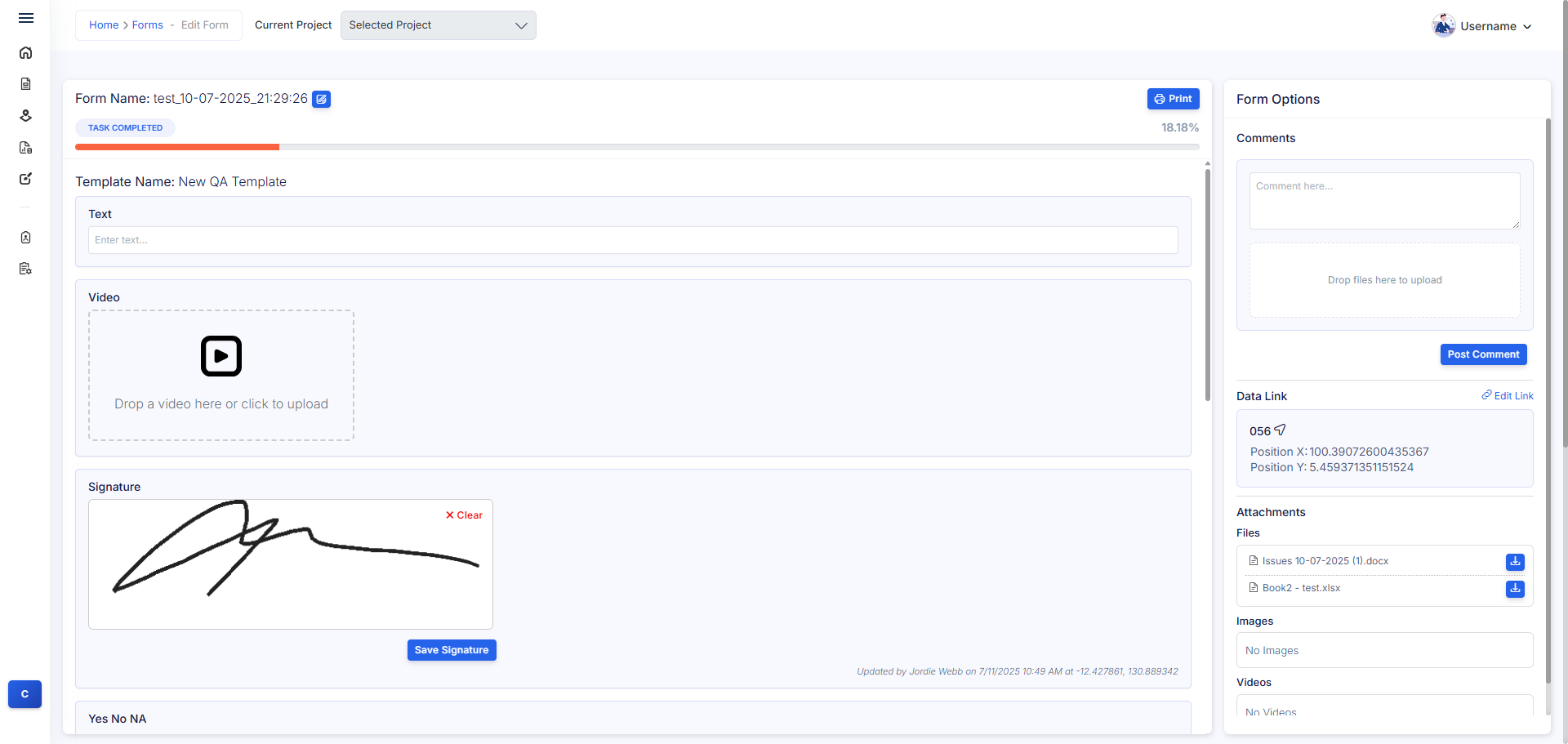
Advanced Form Builder
Design complex forms with conditional logic, validation rules, and multimedia support. From simple text fields to signature capture and file attachments - build exactly what you need.
Built for Your Industry
Specialized solutions for diverse field operations
Construction
Site inspections, quality control, and progress tracking
Infrastructure
Asset management and maintenance workflows
Utilities
Network monitoring and service documentation
Environmental
Environmental monitoring and compliance reporting
"I would thoroughly recommend using Oriyent, it makes our life so much easier here. We get information presented to us in a consistent and accurate fashion."
Simple, Transparent Pricing
Choose the plan that's right for your team size and needs
Team (Mobile-Only Access)
Essential mobile access features
Creator (Web + Field Access)
Full web and field capabilities
Enterprise Custom
Tailored solutions for large-scale operations
Ready to Transform Your Field Operations?
Join thousands of teams who trust Oriyent to manage their field workflows with precision and efficiency. Start your free trial today.